We’ve just returned from seven days in the amazing Portugese archipelagos known as The Azores, and what sights there were to behold!
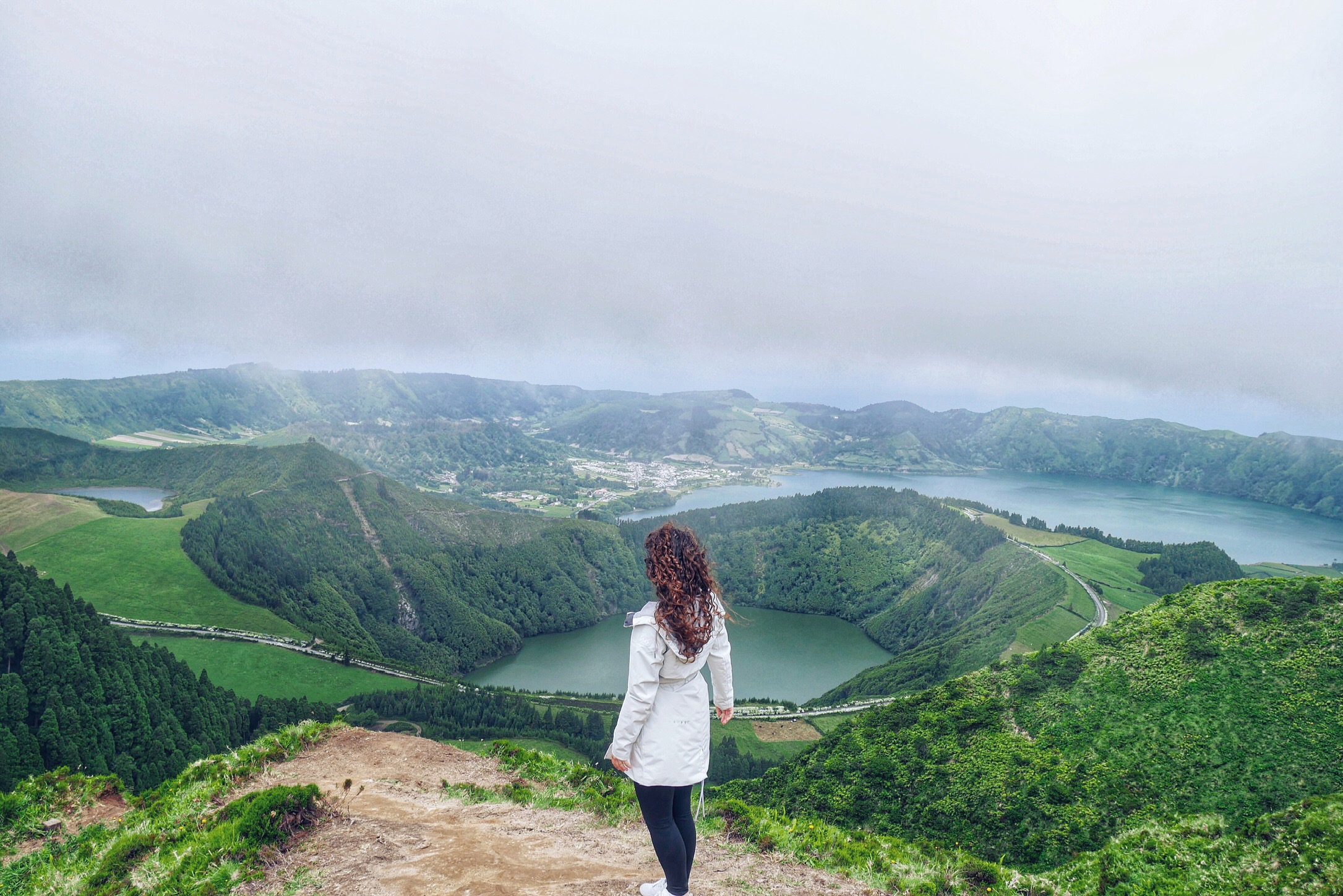
From vibrant green volcanic crater lakes to dreamy hydrangea-lined country roads to pristine sandy beaches, everywhere we traveled in the Azores was positively postcard-esque—and topping the list was Sete Cidades’ Miradouro da Boca do Inferno.
Translating to English as “The Mouth of Hell,” this has got to be one of the most heavenly places we discovered during our stay. 😇
If you’re planning a trip to the Azores, this needs to be on your itinerary! But with next-to-no signage or trail indicators, the famous viewpoint is easy to miss.
That’s why we created this photo guide to help you get there (when your phone’s GPS stops working in the mountains—yep, that happened) and know what to expect along the way.
📍 Miradouro da Boca do Inferno GPS Coordinates: 37.8430° N, 25.7633° W
WHAT TO EXPECT DRIVING:
It’s safe to punch Sete Cidades into your phone’s Google Maps app or handy Garmin, but don’t be surprised if halfway there, they just cease working or start recalculating as you miss unmarked turns.
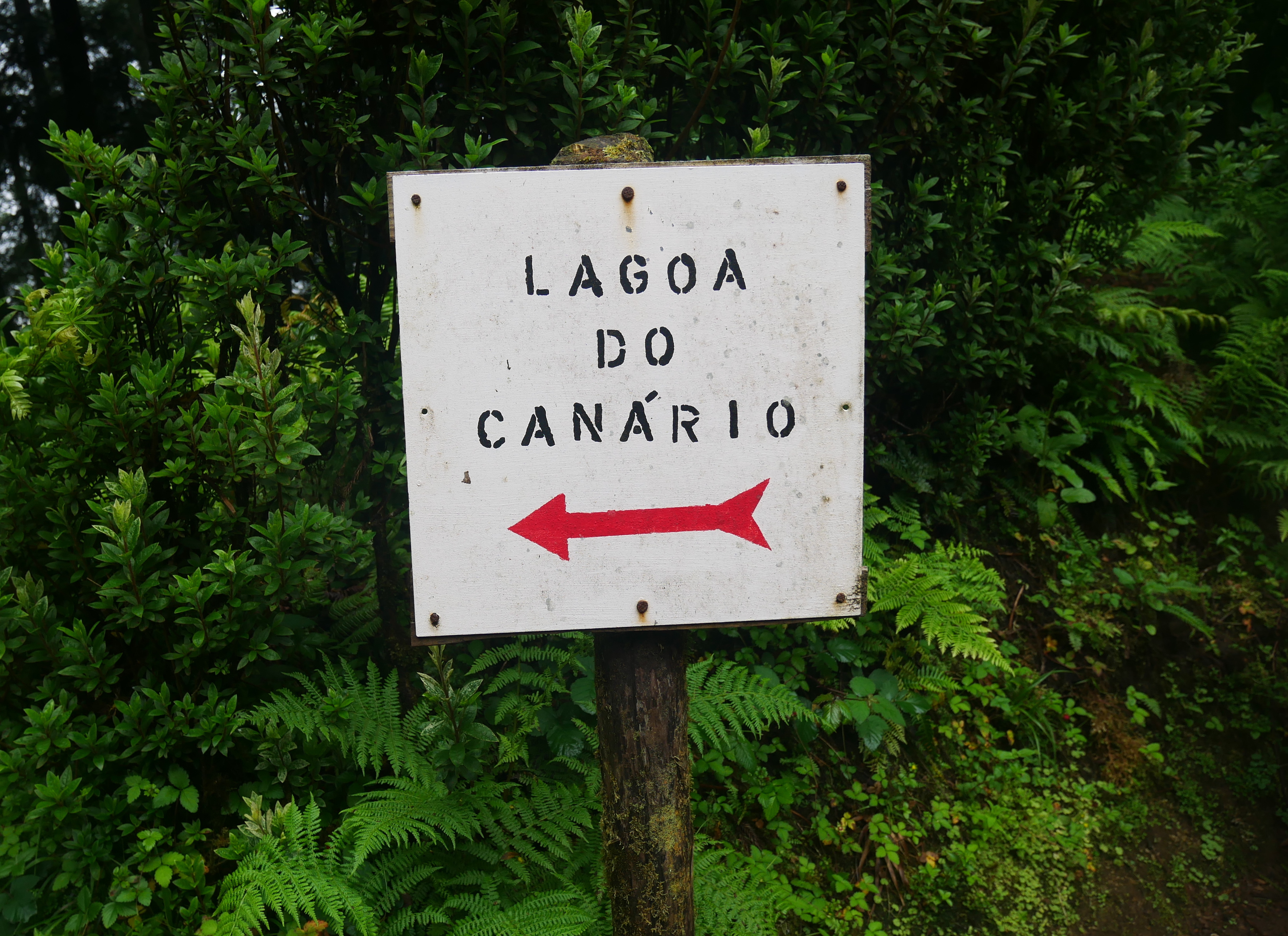
As long as you follow the big brown signage toward “Sete Cidades” you should reach a large green gate for “Lagoa do Canário” which is where you’ll find the right trailhead.
As far as the terrain goes, the route to Sete Cidades / Lake do Canario area is entirely paved so a compact car without all-wheel drive can make the trip with ease (although you may find yourself dropping into first or second gear at times on steep inclines).
The drive out promises long stretches of enormous hydrangea flowers that are just gorgeous regardless of weather conditions—like the fog we experienced that only seemed to get denser and the denser as we drove.
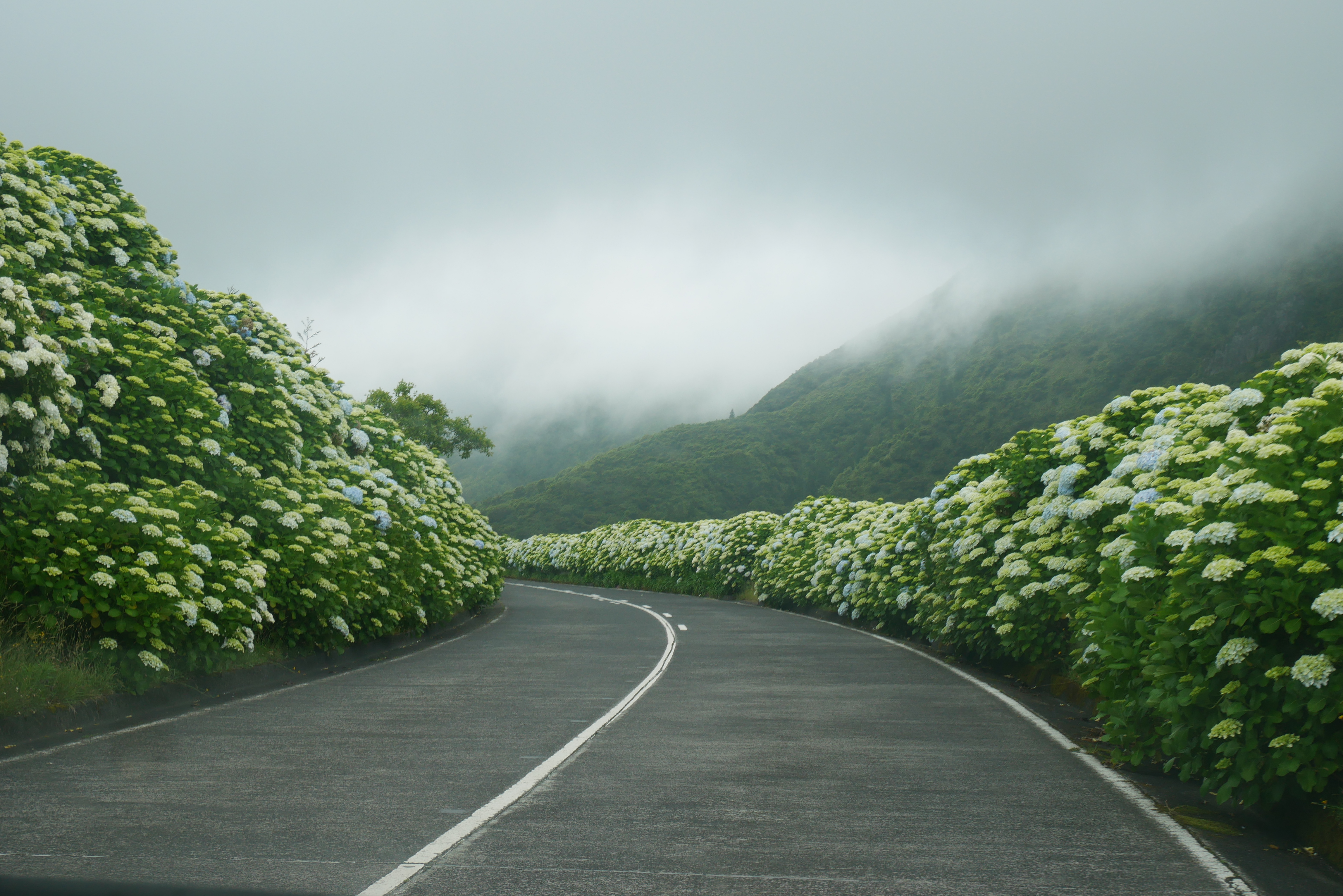
Be advised, as with most mountainous routes, the roads are extremely narrow and windy, and there are few turnouts to let other cars pass if you are more, shall we say—patient? Safety-conscious?—than other drivers.
Do not let other drivers pressure you into exceeding the speed limit. There’s loads of roaming livestock in this area, and we had many a driver go zipping around us on a bend only to find a cow in the middle of the road. ⚠️🐄
Good thing we had sufficient time and space to stop or this could have caused a collision. There are signs everywhere as well indicating high risk of rolling cars so take the time you need to ensure a trip that’s as safe as it is exciting.
WHERE YOU CAN PARK:
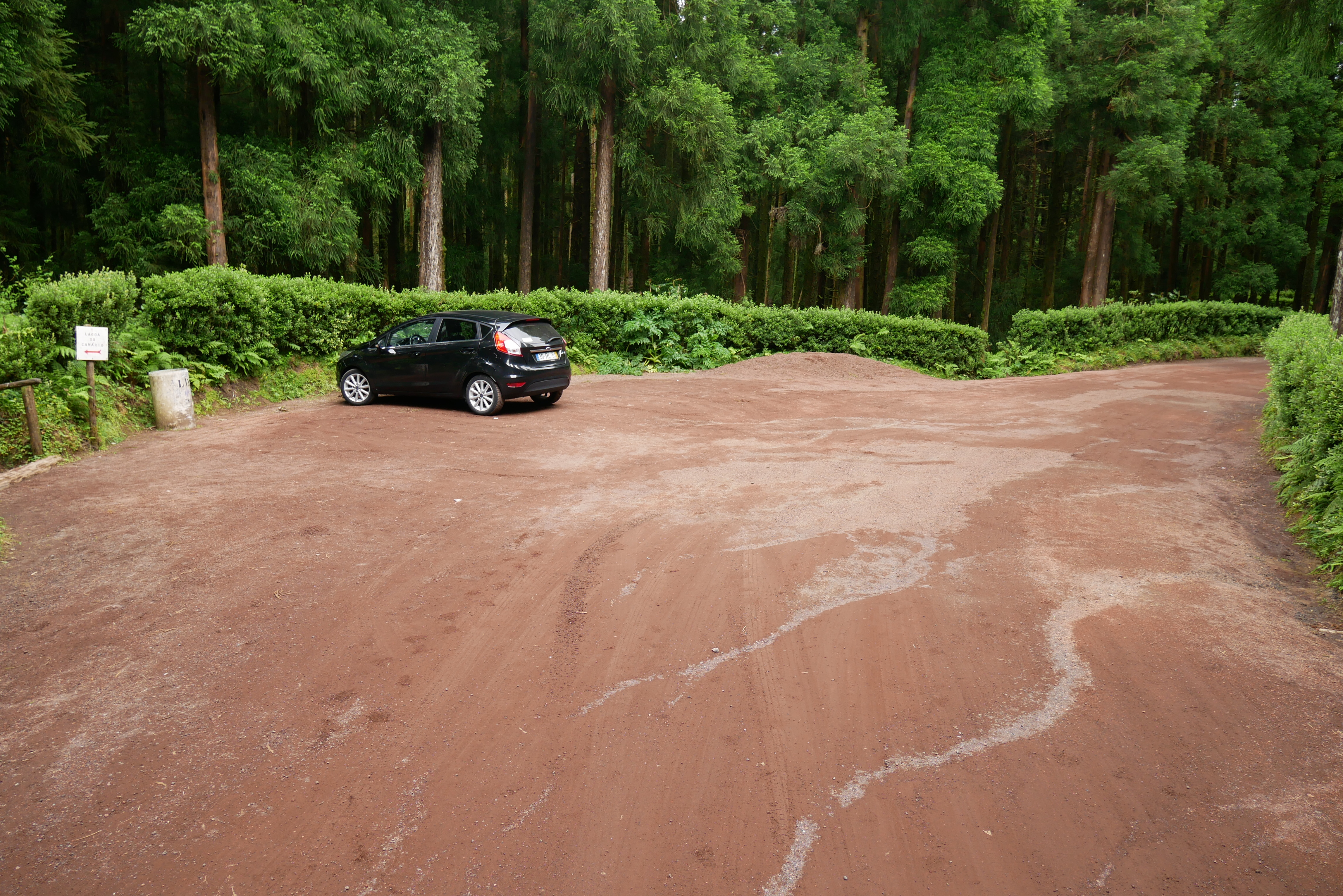
There are a few areas at the top of Lagoa do Canário where you can park free of charge, one small fenced lot directly across from the entrance gates and another fairly long stretch of rust-colored pavement off the main road. This is where we parked.
There aren’t any car stall lines, so just be mindful of how close to other cars you park and don’t leave more space than is necessary just to make life easy for yourself. Traffic fluctuates a lot throughout the day in this area and we barely squeezed in!
It’s wise to back your vehicle into a space so you can easily pull out onto the main road when it’s time to leave. You can, however, also turn into the gated entrance to Lagoa do Canário if it’s open and drive to the actual trailhead if you like, but it’s only a fifteen minute walk or so if you park at the top. The choice is yours!
HOW TO REACH THE LOOKOUT POINT:
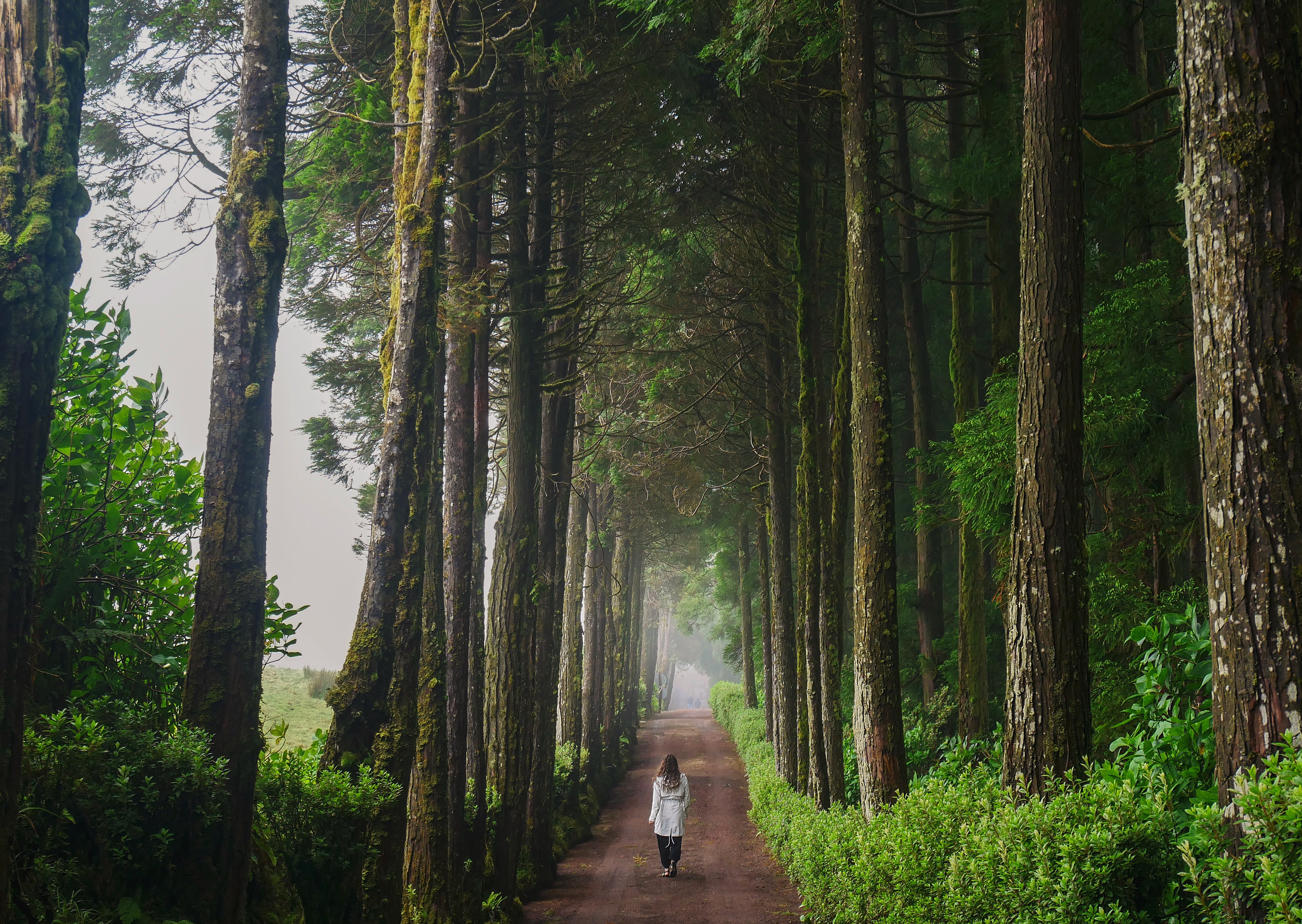
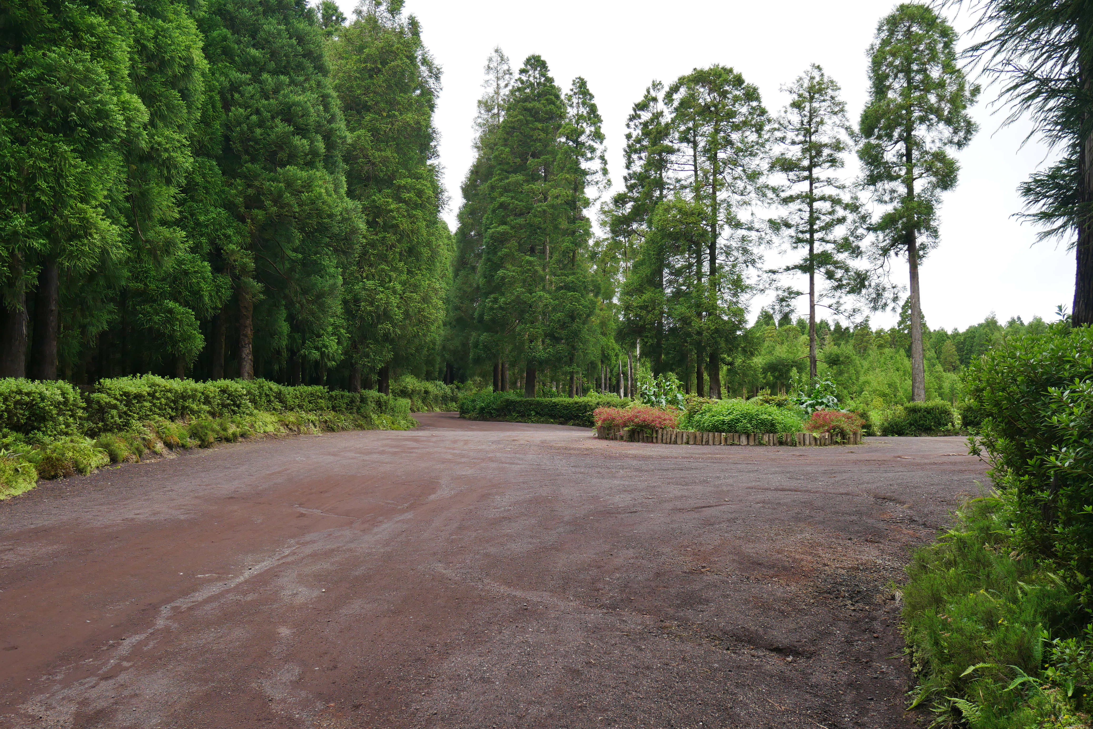
Once you pass through the entrance gates, you’ll find yourself walking down this tree-lined road that’s, again, red in color.
You should see wooden rails on the left-hand side with a sign marking a trail down to Lagoa do Canário.
Continue walking straight at this point and keep left when you reach the first split in the road. You should see yet another set of wooden rails on the left-hand side leading down with signage for Lagoa do Canário.
Continuing to the left, you should come to a roundabout in just a few minutes time.
Bearing right at this point will take you through a picnic area (where there are bathrooms should you need to relieve yourself) and circle back to the entrance gates.
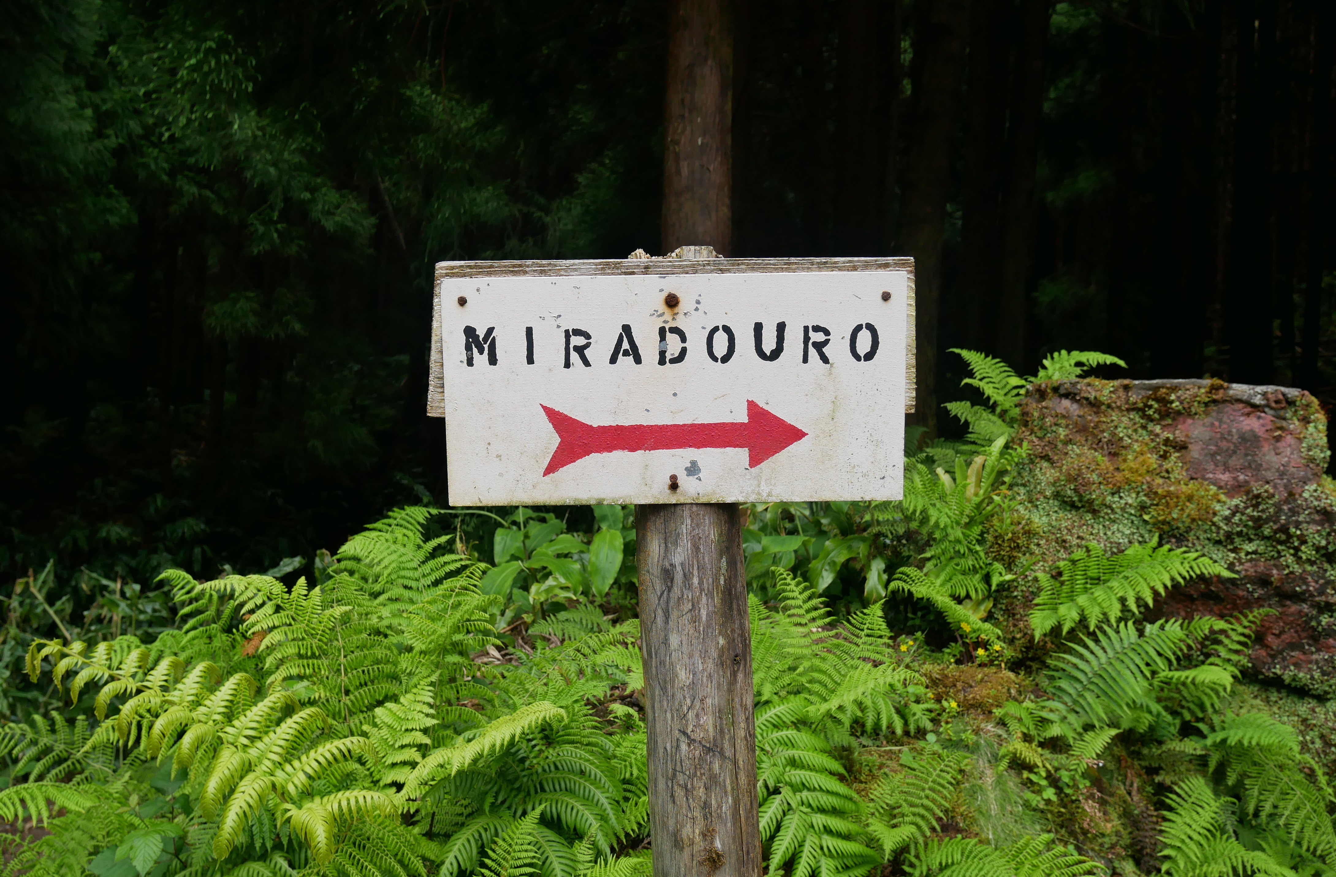
Bearing left will keep you en route to the Miradouro trailhead, which is where you’ll begin your brief ascent to reach the Boca do Inferno viewpoint.
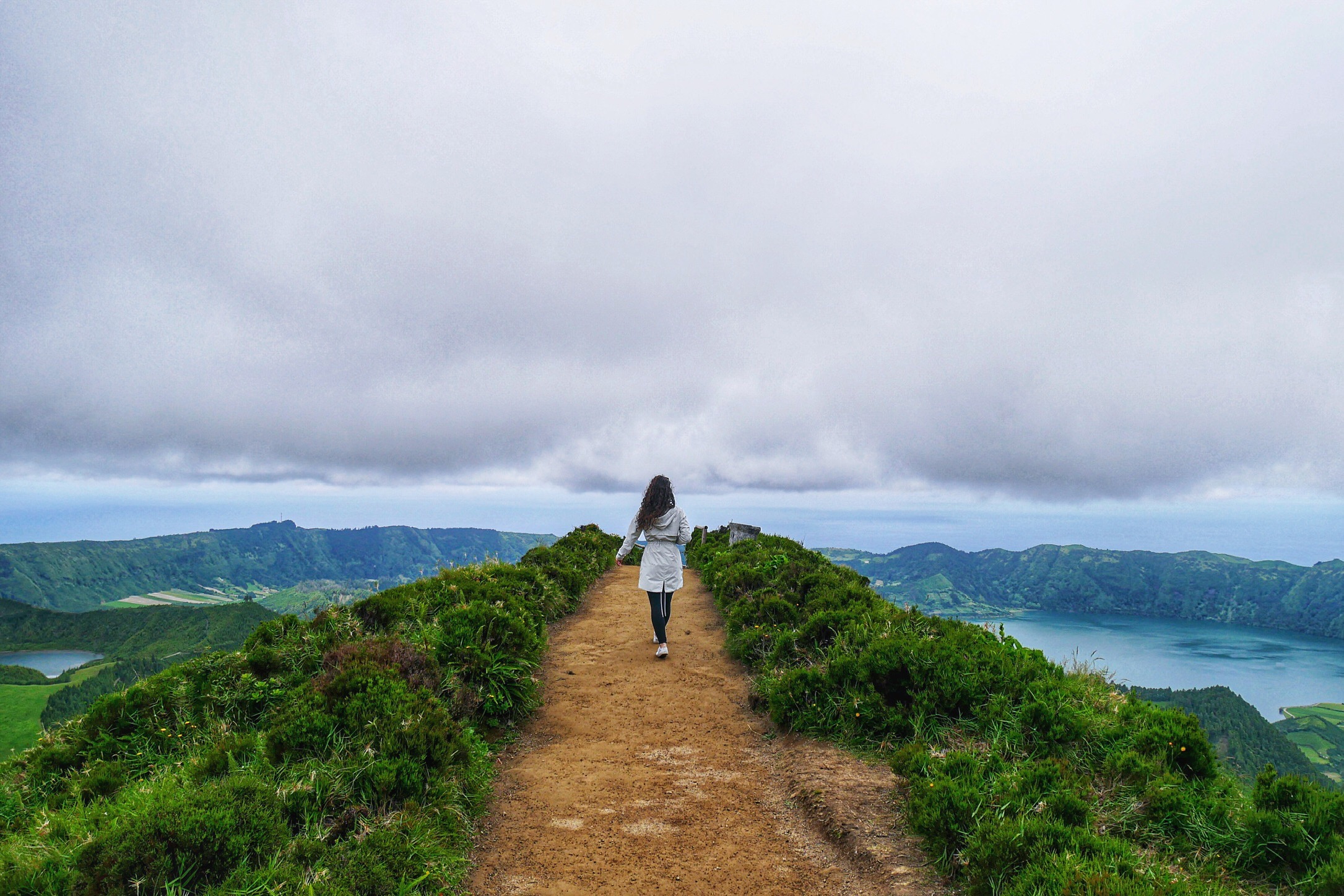
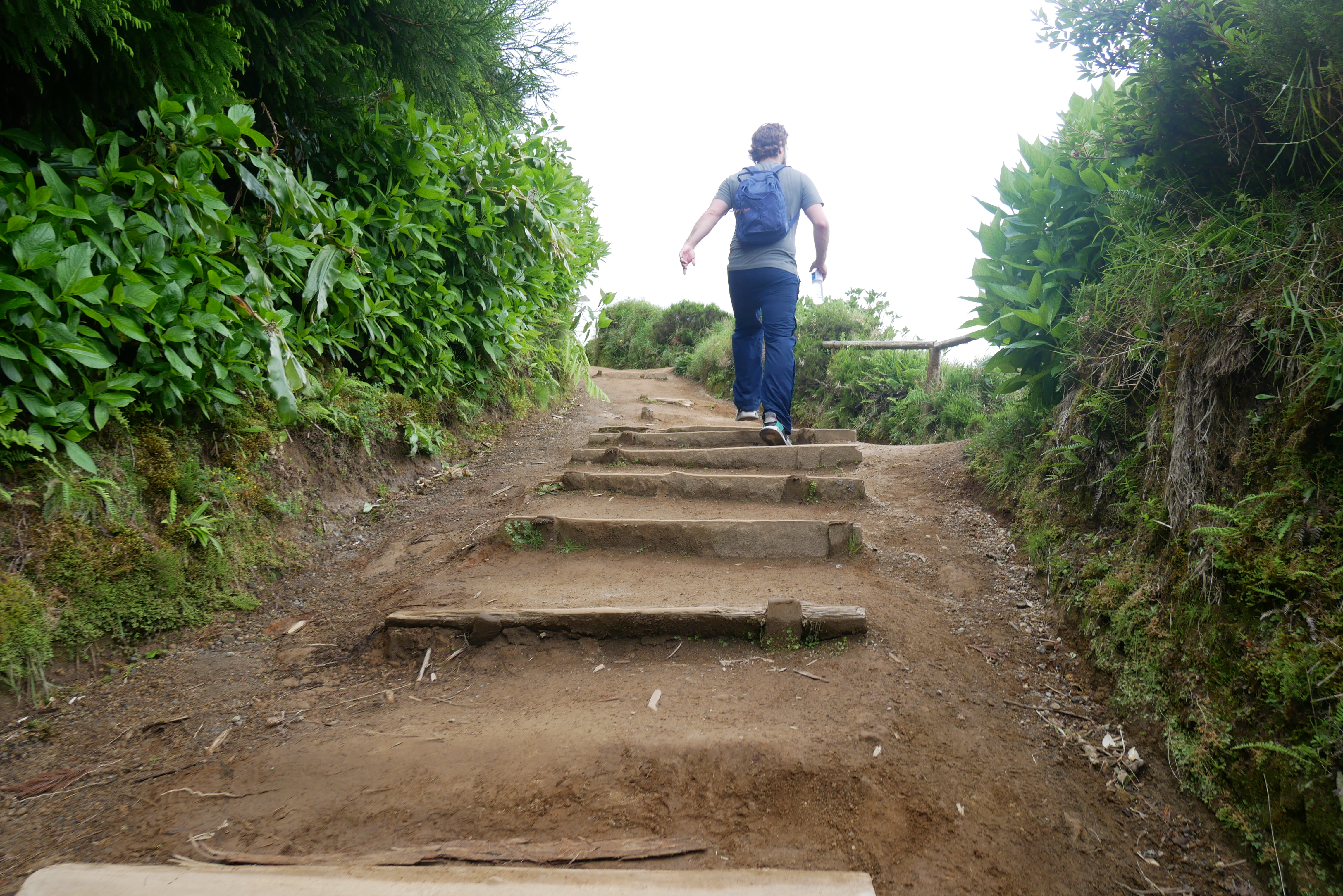
From here, it’s between a 7 and 10 minute walk to your final destination so get excited! If you’ve driven in, you’ll find an extended parking area on the right-hand side of the road just next to the trailhead, which is marked with this Miradouro sign. 👇
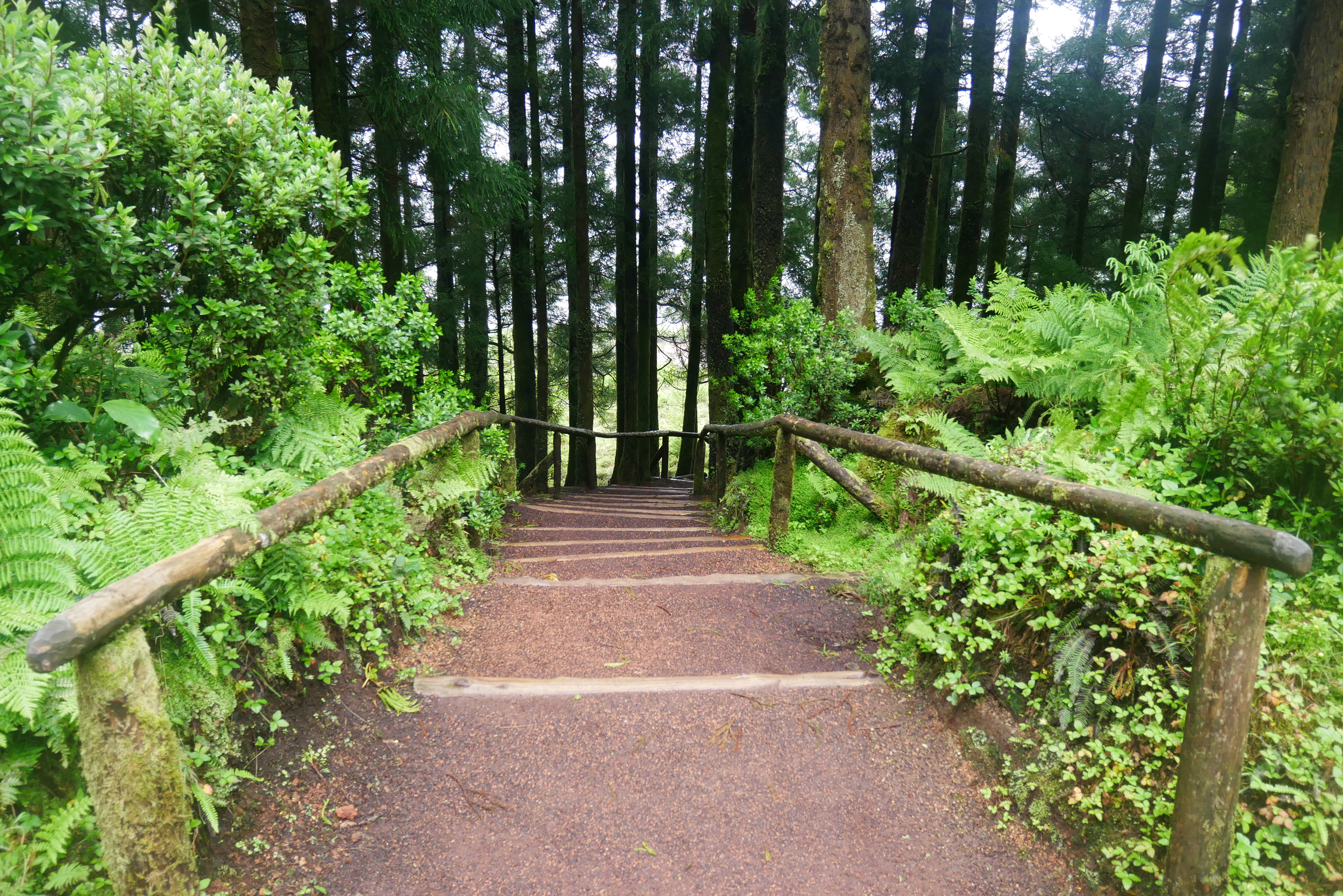
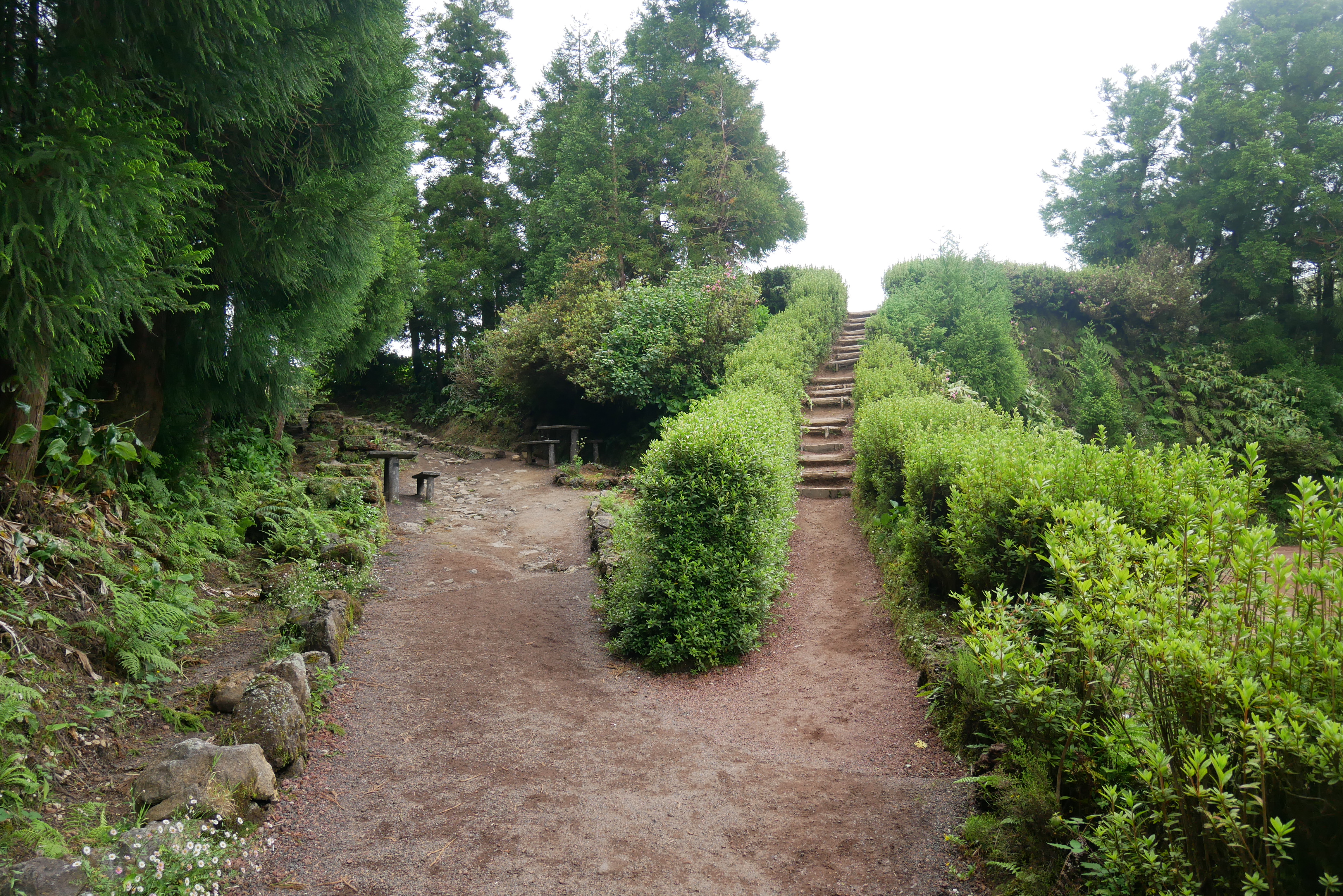
The trailhead is split but you can take either side up; they lead to the same spot. And you’re not in for much hiking at all to reach the actual viewpoint; a quick little climb up these stairs and you’re there!
WHAT ELSE YOU SHOULD KNOW:
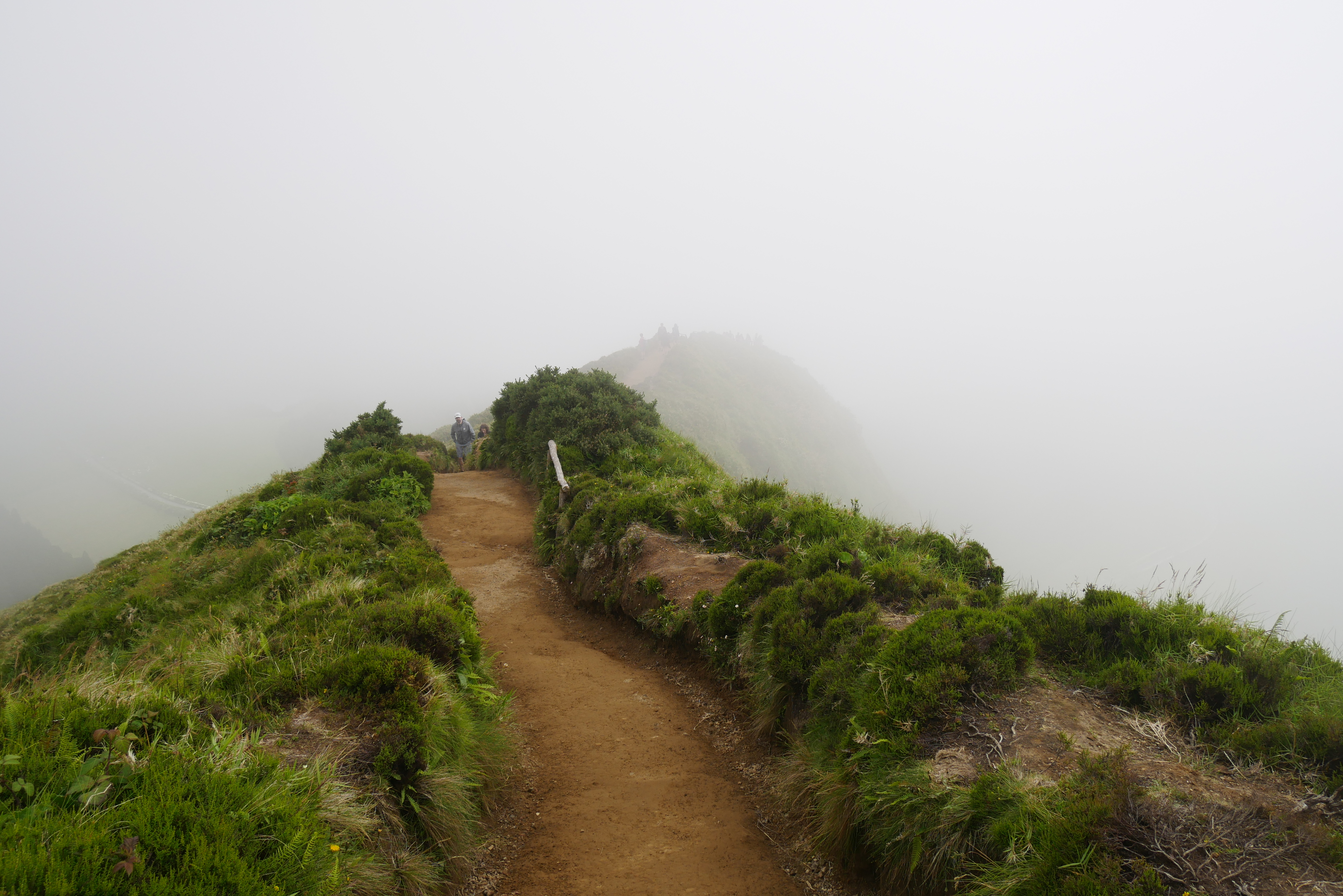
There’s a super helpful site called Spot Azores that offers live feed from webcams all around the islands if you fancy a quick weather check, but in our experience, the weather changes so dramatically in such a short amount of time here that it doesn’t really help to know if the forecast is clear and sunny before you leave—it’s probably going to change a few more times along your journey.
If you get to the top only to find the entire view obstructed by fog, fear not! Like we said, the weather changes quickly and dramatically. Just be patient and you’ll be rewarded with one of the most breathtaking panoramas ever.
📸 These pictures were taken roughly 10 minutes apart.
🚻 If you need the facilities (this was mentioned above, but I know a lot of us our skimmers!) there are a few bathrooms down the alternate road from the roundabout.
There are picnic areas and other trails here as well, although during our visit a lot of them had been blocked off due to weather damage and high risk of mudslides.
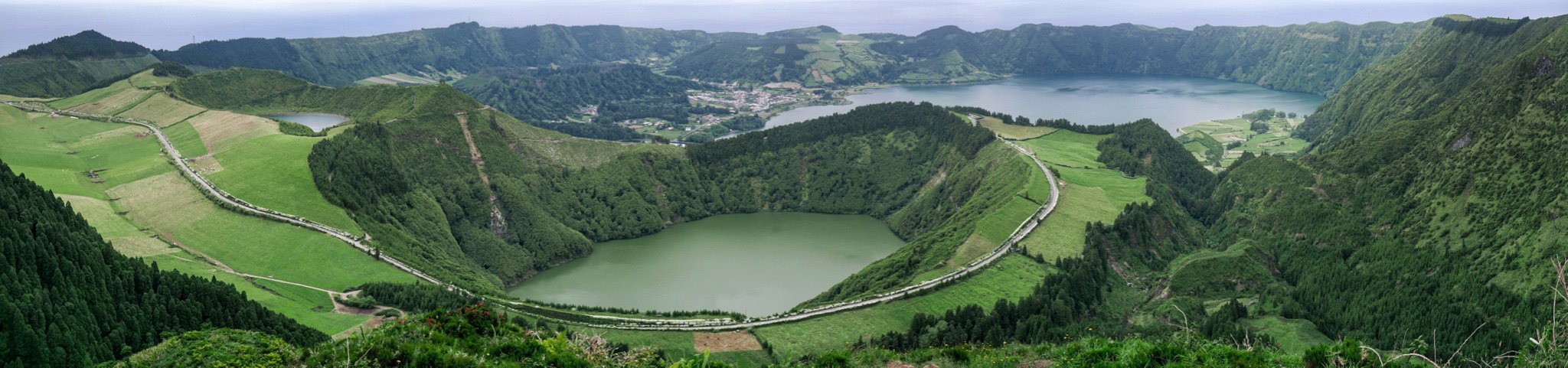
🌋 If you’re curious about the geological history of this place, signage indicates that the caldera was formed after a major series of volcanic eruptions and collapses. The two lakes you can see from this vantage are Lagoa Azul (Blue Lake) and Lagoa de Santiago.
📜 Local folklore and myth tell the story of two lovers—a green-eyed princess (Antília) and a blue-eyed shepherd boy—who were forbidden from seeing one another, when the shepherd asked her widowed father & King for her hand in marriage.
Ejected from the kingdom, Antília met with the shepherd boy once more in secret, telling him they would never see each other again. The pair cried together and their tears are said to have formed the Blue Lakes and Green Lakes—so named for their eyes.
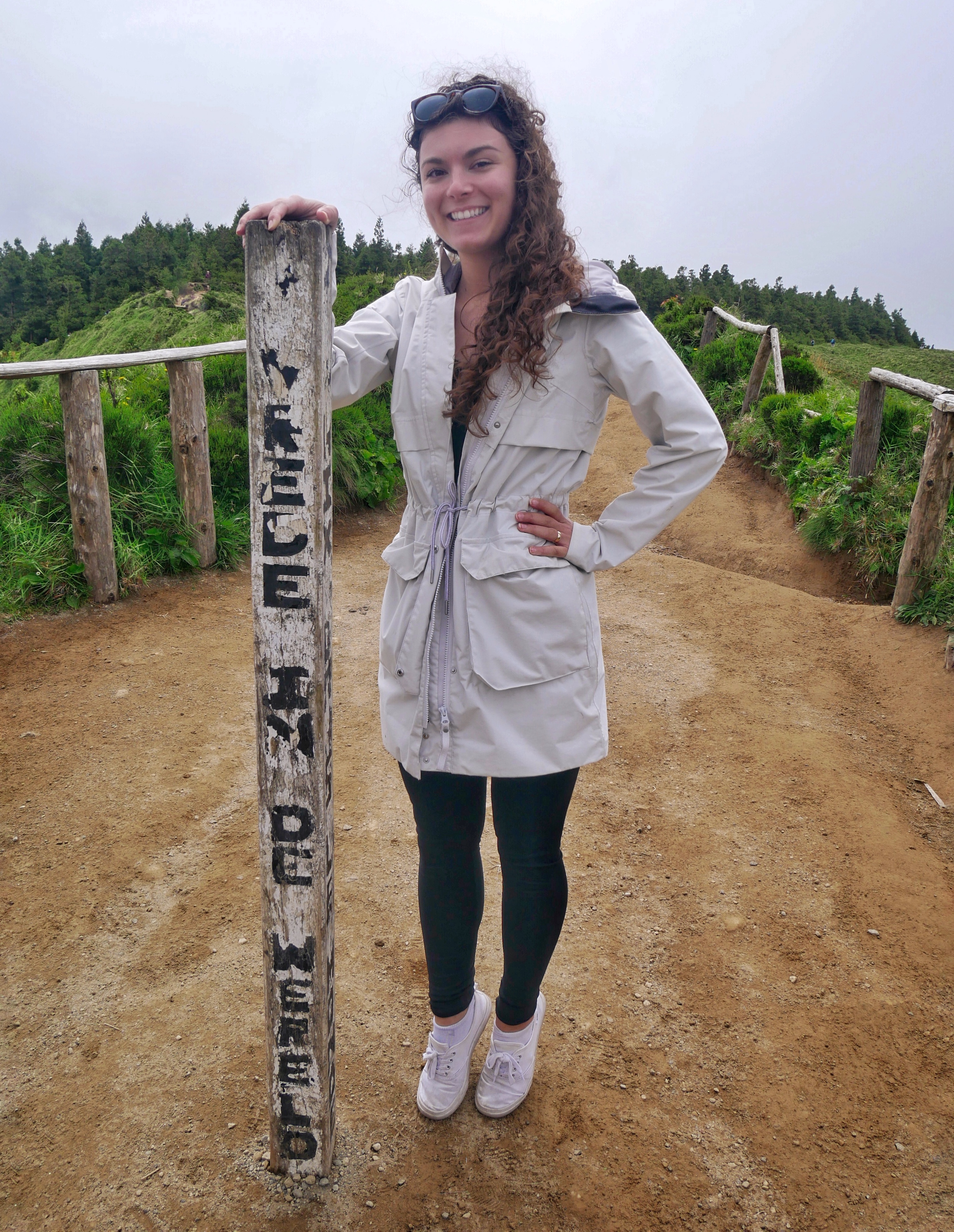
✌️ Wondering what that worn out hiker’s post at the top of the viewpoint reads? “Vrende in de wereld,” which translates from Danish to English as “Peace in the World.”